
I think I've said as much as there can be said about my road trip (four posts over the span of almost a month seems sufficient). The drive to Niagara/Toronto was not the only road trip we've done, but it was definitely the most sentimental. It was our first road trip, our first vacation in general, and it spawned so many little inside jokes. It became ritualistic to say, "I wonder where you'd be if you just took that road to the very end." every time we'd pass by the Mass Pike/90 West (hint: it ends in Canada).
So, God bless
Martha Stewart, because she came up with an idea to commemorate a road trip.
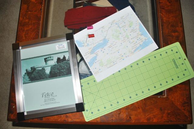
I needed: an 8 x 10 frame, large needle (one you can thread two strands of thread through easily), and a road map.
After a lot of online searching, I decided to print out the Google maps version of the Northeast. The only maps that I could find that incorporated only New England and New York were rare antique maps. Yeah, like I'm going to mess with that!
With Google maps, it's as simple as finding the area where your road trip took place on Google, zooming in the correct amount, and screenshotting/"grab it"ing (PC and Mac, respectively). You can collapse the various columns on the page/navigation bar in the window to get a bigger picture.
The best part is that most photo-editing software allows you to resize the photo according to inches. I sized mine to about 8.25 x 10.25 so I would have some wiggle room. Adjust the paper settings to the picture will be neatly printed on one sheet of paper and
tada you're done.
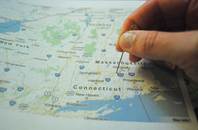
Using the needle, poke holes along the route of your roadtrip, about 1/2 a centimeter apart. The space between holes needs to be far enough apart that the thread won't rip into the adjacent hole, but close enough so you'll be able to see the twists and turns of the road.
If you don't remember the trip exactly, consult Google Maps again (or consult whoever was manning the vehicle).
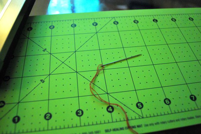
I threaded two tones of red, and made sure the length of the thread was at least 4x the length of the trail on the map. You can use any color combination, but I think two tones of the same color really make the trail "pop".
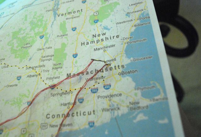
And now, for the first time ever, I attempted the backstitch. And it turned out to be incredibly simple. First, thread the needle from the bottom through the second hole, then down through the first hole.
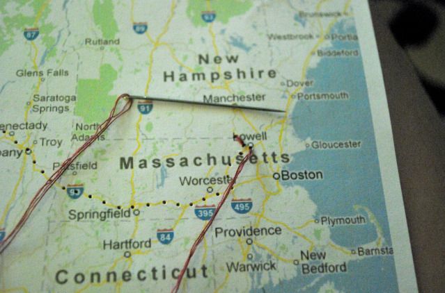
Thread the needle back up through the third hole.
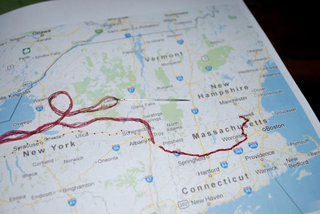
It's as simple as that: up the second hole, down the first hole, up the third hole (I can already hear my husband snickering in the background). You'll start producing a very nice, textured line. Be careful, though -- the thread tangles easily and you
are dealing with paper!
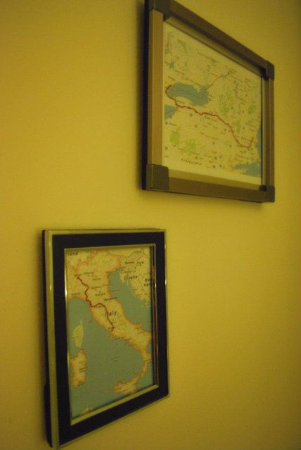
Once I made this one, there was no stopping me. I found another frame while cleaning up the apartment and made one for our honeymoon (granted, this route was by train, but Google Maps helped me out yet again by showing me how to get from each city via public transit). The best part is that there are at least a few more I can make (like the one
from Boston to Ohio or one
summing up our New England road trips). I might end up dragging my husband or my best friend on more road trips just so I have an excuse to make more of these.
This project reminded me that I'm already outgrowing this apartment and getting ready for us to be home owners. I can totally see me adorning a wooden-walled den with countless roadtrip map frames. Or in an office/"writer's room", decorating every bit of free space. But first things first: get a house, and go on more road trips!
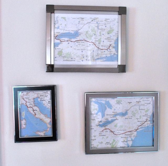
Edit: In order to save some money (fittingly, for a house), my husband and I have decided to drive to Ohio for Christmas this year, like we did four or so years ago. In honor of that:


No comments:
Post a Comment